Wednesday, October 8, 2014
Tucson Mountains Trail Hound: Robles Pass Trail System
Welcome, fellow hikers and desert lovers, to the first edition of Tucson Mountains Trail Hound, a new endeavor dedicated to detailing some of the lesser known trails in the Tucson Mountains, west of the city.
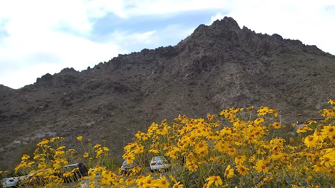
Cooler weather should soon (hopefully!) be here, which for many of us means: it’s hiking season. The abundant late summer monsoons we had in the last several weeks dumped large amounts of water onto the surrounding desert, and the beautiful Sonoran landscape around Tucson is thick and lush with abundant greenery, a chest-high jungle of healthy looking desert foliage.
Here in Tucson we’re blessed to be surrounded by mountain ranges on the west, north and east sides of the city, with others further away to the south, and still other ranges rolling out in waves behind our immediate, localized peaks and valleys; a sea of sky islands, all unique, all beautiful and all with their own opportunities for hiking and exploration.
While the Santa Catalina’s to the north and (to a lesser degree) the Rincons to the east offer up verdant canyons, steep trails, creeks, falls and endless miles of trails, the lower lying Tucson Mountains are the most accessible in the area, and probably the easiest to take for granted. But these mountains - in and out of Tucson Mountain Park and Saguaro National Park West - are a labyrinth of trails long, short and medium in length, with endless opportunities for anyone that has an hour or three or four, and wants to see and be in the remarkable Sonoran Desert landscape up close and personal.
Featured Trail: Robles Pass Trail System (Bittersweet/Camaro/Sunset Pass loop)
Approximate drive from downtown to trailhead: 15-20 mins.
Approximate length of trail: 3-3 1/2 mile loop
Difficulty: low
Highlights: majestic crested saguaro, beautiful, garden-like ambience
Please note: all distances are approximates, based on guestimates, with help from a map or trail guide whenever possible. If something is off 1/4 mile or so, you heard it here first.
Our first offering is a loop trail in the Robles Pass trail system, an interlocking set of trails between Ajo Way and Irvington Road on the north and south, and Mission on the east and whatever is south of Kinney Road on the west. This is a terrific, little used series of trails, just a few minutes drive from downtown Tucson. The area is a series of low-lying hills, with housing around the fringes; most of the trails are very easy and seldom involve much up or down. Click here to see what it looks like from above.
To get to this particular trail loop, travel west on Ajo Highway to the 4140 marker, at Bilbray Road. You can either take a left and cross Ajo directly onto Bilbray, or go to the next left (before Kinney Road) and double back. Go approximately 100 yards down Bilbray and take a left on Coyote Ridge Road; drive roughly 1/3 of a mile down this dirt road, to a more-or-less a dead end at a fence, where there’s ample parking. There’s a driveway off to your right; you do not want to go down this road. Instead, there’s an opening in the fence immediately on your right if you’re facing the fence, which leads to a trail that angles off to the right. This is where you get on the Bittersweet Trail, even though there’s no trail marker at this point. Do not walk down the wash that runs directly east from the break in the fence; unless you want to freestyle in the desert, of course.
The Bittersweet Trail ambles in a SE direction, before looping around at a small promontory and heading north, then back west, before a switch back heads east where it connects to the Camaro Trail 1.7 miles from the trail head. Be sure and not take the right at a split onto the Cascabel Trail; it’s clearly marked. At one point you are paralleling Irvington Road, and see neighborhoods heading south; the desert suddenly gives way to houses below, and then they’re gone again just as quickly.
For a longer (1 1/2 mile longer) loop, turn right at the Camaro Trail connection; our loop goes left, where it passes the trail’s namesake, an old Camaro somehow run deep into the desert and left to rust. You’ll see this on your right, roughly 1/3 of a mile down the trail, at a bend. After crossing a wash and heading up the hill you’ll connect with the Sunset Pass Trail on the left; take the left, and the next left a few yards up the trail onto the Sunset Trail; both are clearly marked. The Sunset Trail is an easy .8 (or more, depending) walk west, back towards the break in the fence. There’s a beautiful crested saguaro on the left as you’re getting closer to the end. If you want to knock a good 1/2 mile off of the return, you can cut from the Sunset Trail right down to the return route on the Bittersweet by cutting through the desert, 30 or 40 yards, exactly where the Vista Trail runs into the Sunset Pass Trail from the north and east, just past the crested saguaro. If you’re driving, you should be able to see your vehicle, and the return trail, from here.
The total length of this loop is 3 or 3 1/2 miles, depending on if you shortcut at the end or not.
This whole area, although ringed on all sides by houses, has a beautiful, garden-like ambience. It’s full of the usual Sonoran mixture of prickly pear, buckhorn cholla, palo verde, creosote, ocotillo and mesquite. It has a nice population of healthy looking saguaros, not as dense as some other surrounding areas, but very present, and projecting their usual understated majesty. It’s easy, accessible, and generally very quiet and sparsely used.
REMEMBER: watch out for rattlesnakes! They curl up under bushes and cactus and between rocks, and can often barely be seen. It’s important to watch every inch of trail, and whatever pile of rocks you take a break on. I’ve seen several in the last few weeks, and the hiking season is just getting started.
More, soon.
Tags: Robles Pass Trail System , tucson hiking , tucson hikes , tucson mountain hikes